
Think We Don't Know What We Are
Talking About?
"The Center for Self-Reliance
Studies," was our original attempt at creating a survival group. It was
humming along nicely until personality conflicts (or perhaps
philosophical incompatibility) pretty much shut things down. If you want
to see the extent of planning and thought were involved, follow the
links, below.
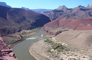
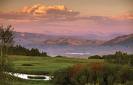
SC² - The Summit County Survival Community
Actually encompassing Summit and Grand Counties in the north-central
Colorado Rockies. It is a large valley bounded by the Rabbit Ear Range on the
north, the Continental Divide on the east and south, and the Gore and Ten Mile
Ranges on the west. The Rabbit Ears range also comprises the Continental Divide
at this point. This means that three borders of the SC²
(north, east and south) are entirely protected by the highest mountain ranges in
the United States. Only the western borders are not
a part of the Continental divide, and these ranges are nearly as tall.
The SC² includes:
GRAND COUNTY: 2006 Population (Est): 13,406; Land area:
1847 sq. mi.; Water area: 22.9 sq. mi.; Population density: 7 people per square
mile (very low).
Elkdale - at latitude 40.04 and longitude
-105.881. The elevation is 8,163 feet. Unincorporated
Fraser - at 39°56′39″N, 105°48′48″W, elevation of
8574 feet. Population in July 2007: 894
Gaskil - at latitude 40.331 and longitude
-105.862. The elevation is 8,786 feet. Unincorporated
Granby - Latitude: 40.09 N, Longitude: 105.94 W,
7939 feet elevation. Population (year 2000): 1,525
Grand Lake - Latitude: 40.25 N, Longitude: 105.82
W, 8437 feet elevation. Population in July 2007: 435.
Hideaway Park - at latitude 39.918 and longitude
-105.786. The elevation is 8,796 feet. Unincorporated
Hot Sulphur Springs - Latitude: 40.07 N,
Longitude: 106.10 W, 7680 feet elevation. Population in July 2007: 515.
Kremmling - Latitude: 40.06 N, Longitude: 106.39
W, 7362 feet elevation. Population in July 2007: 1,538.
Leal - at latitude 39.81 and longitude -106.044.
The elevation is 8,871 feet. Unincorporated
Maryvale - at latitude 39.933 and longitude
-105.787. The elevation is 8,704 feet. Unincorporated
Parshall - at latitude 40.057 and longitude
-106.175. The elevation is 7,588 feet. (@80) Unincorporated
Tabernash - Latitude: 39.99 N, Longitude: 105.85
W, 8326 feet elevation. Population (year 2000): 165.
Troublesome - at latitude 40.061 and longitude
-106.292. The elevation is 7,362 feet. Unincorporated
Winter Park - Latitude: 39.90 N, Longitude:
105.78 W, 9040 feet elevation. Population in July 2007: 852.
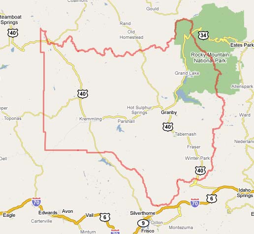
As you can see... there are only 6 routes into Grand
County!
2008 cost of living index in Grand County: 86.5
(less than average, U.S. average is 100);
Industries providing employment: Arts, entertainment, recreation,
accommodation and food services (22.8%), Construction (14.2%), Retail trade
(11.5%), Educational, health and social services (11.4%).
Notable locations in Grand County: Phantom Valley
Ranch, Phantom Valley Trading Post, Pine Beach Picnic Area, Drowsey Water Ranch,
Pinney Ranch, Point Break Picnic Area, Administrative Site Rocky Mountain
National Park, Fraser Experimental Station, Quinette Point Picnic Area, Rabbit
Ears Lodge, Radium, Rainbow Bay Picnic Area, Ritschard Ranch, Roaring Fork
Campground, Roaring Fork Ranger Station, Roaring Fork Trailhead, Robbers Roost
Campground, Colorado State Rifle Range, Columbine Bay Campground, Columbine
Lodge.
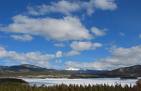
Lakes and reservoirs: Fourth Lake, Julian Lake,
Lone Pine Lake, Nanita Lake, Pumphouse Lake, Murphy Lake, Upper Lake, Saint
Louis Lake.
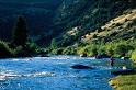
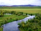
Streams, rivers, and creeks: Adams Creek, Williams
Fork, Lady Creek, Albert Creek, Alkali Slough, Ammons Creek, Antelope Creek,
Arapaho Creek, Rabbit Ears Creek.
Parks in Grand County include: Hot Sulphur State
Wildlife Area, Fraser Experimental Forest, Platte Park, Shadow Mountain National
Recreation Area, Big Park.
Agriculture in Grand County:
Average size of farms: 1269 acres
Average value of agricultural products sold per farm: $42155
Average value of crops sold per acre for harvested cropland: $54.39
The value of livestock, poultry, and their products as a percentage of the total
market value of agricultural products sold: 85.30%
Average total farm production expenses per farm: $56501
Harvested cropland as a percentage of land in farms: 8.97%
Irrigated harvested cropland as a percentage of land in farms: 90.03%
Average market value of all machinery and equipment per farm: $99549
The percentage of farms operated by a family or individual: 78.61%
Average age of principal farm operators: 55 years
Average number of cattle and calves per 100 acres of all land in farms: 6.77
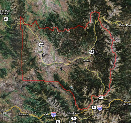
Note the protective terrain - Continental divide to the east, Rabbit Ears Range
to
the north, and Gore range to the west. The valley to the south is Summit County.
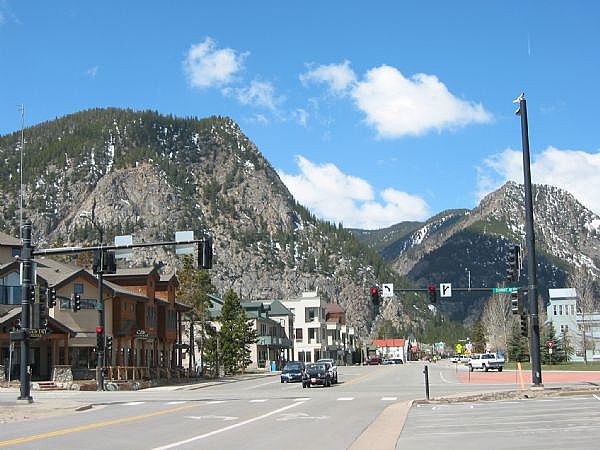
SUMMIT COUNTY: County population in 2007: 28,296; Land
area: 608 sq. mi.; Water area: 11.1 sq. mi.; Population density: 41 people per
square mile (average).
Blue River - Latitude: 39.43 N, Longitude: 106.04
W, 10020 feet elevation. Population in July 2007: 923.
Breckenridge - Latitude: 39.49 N, Longitude:
106.04 W, 9602 feet elevation. Population in 2007: 3,535
Copper Mountain - Latitude: 39°30′06″N,
Longitude: 106°09′23″W, 9,712 feet elevation. Unincorporated
Dillon - Latitude: 39.63 N, Longitude: 106.04 W,
9087 feet elevation. Population in July 2007: 820
Frisco - Latitude: 39.58 N, Longitude: 106.10 W,
9042 feet elevation. Population in July 2007: 2,772
Heeney - at latitude 39.872 and longitude
-106.301. The elevation is 8,045 feet. Unincorporated
Keystone - Latitude: 39.60 N, Longitude: 105.95
W, 9280 feet elevation. Population in July 2000: 825
Lincoln - at latitude 39.487 and longitude
-105.986. The elevation is 10,236 feet. Unincorporated
Masontown - Latitude: 39.56639 : Longitude:
-106.09972 : Elevation: 9380 ft. Unincorporated
Montezuma - Latitude: 39.58 N, Longitude: 105.87
W, 10335 feet elevation. Population in July 2007: 50.
Silverthorne - Latitude: 39.64 N, Longitude:
106.08 W, 8751 feet elevation. Population in July 2007: 4,055
Wheeler Junction - at latitude 39.506 and
longitude -106.142. The elevation is 9,698 feet. Unincorporated
Other Populated Places in Summit County (Neighborhoods, Subdivisions &
Settlements)
Doenz Place - Latitude: 395418N, Longitude:
1062404W, elevation of 9,000 feet. Unincorporated
Gold Hill - Latitude: 393243N, Longitude:
1060252W, elevation of 9,324 feet. Unincorporated
Slate Creek - Latitude: 394703N, Longitude:
1060946W, elevation of 8,210 feet. Unincorporated
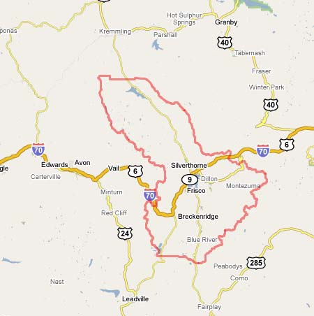
As you can see... there are only 6 routes into Summit
County!
2008 cost of living index in Summit County: 93.6
(less than average, U.S. average is 100)
Industries providing employment: Arts,
entertainment, recreation, accommodation and food services (30.2%), Construction
(13.8%), Retail trade (12.3%), Finance, insurance, real estate, and rental and
leasing (10.3%).
Summit County currently has free bus service to
most locations. It is paid for by a sales tax collected by businesses in the
county. Hard to say how long this will last with rising fuel prices.
Notable locations in Summit County: Peninsula
Recreation Area, Blue River Campground, Blue River Inlet Fishermans Parking,
Pine Cove Campground, Prairie Point Campground, Prospector Campground, Boulder
Creek Campground, Frisco Marina, Sapphire Point Overlook, Breckenridge Ski Area,
Sentinel Island Campground, Slate Creek Ranger Station, Smith Ranch, Snake River
Fishermans Parking, Arapaho Basin Ski Area, Copper Mountain Ski Area, Giberson
Bay Fishermans Parking, Swan Mountain Recreation Area, Cow Creek Campground,
Bakers Tank Picnic Ground, Dillon Marina, Dillon Amphitheater.
Lakes and reservoirs: Curtain Ponds, Upper Cataract
Lake, Upper Crystal Lake, Boulder Lake, Upper Slate Lake, Crystal Lake, Griffith
Lake, Black Lake, Dillon Reservoir, Old Dillon Reservoir, Green Mountain
Reservoir.
Rivers and creeks: Acorn Creek, Bemrose Creek,
Black Creek, Boulder Creek, Brush Creek, Bushee Creek, Cataract Creek, Clinton
Creek, Copper Creek, Blue River, Snake River.
Parks in Summit County include: Windy Point
Fisherman Park (1), Blue River State Wildlife Area (2).
Agriculture in Summit County
Average size of farms: 773 acres
Average value of agricultural products sold per farm: $12924
Average value of crops sold per acre for harvested cropland: $16.46
The value of nursery, greenhouse, floriculture, and sod as a percentage of the
total market value of agricultural products sold: 0.00%
The value of livestock, poultry, and their products as a percentage of the total
market value of agricultural products sold: 91.87%
Average total farm production expenses per farm: $38813
Harvested cropland as a percentage of land in farms: 8.27%
Irrigated harvested cropland as a percentage of land in farms: 76.08%
Average market value of all machinery and equipment per farm: $78468
The percentage of farms operated by a family or individual: 80.56%
Average age of principal farm operators: 58 years
Average number of cattle and calves per 100 acres of all land in farms: 9.05
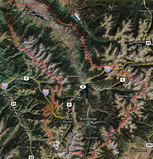
Note the protective terrain - Continental divide to the east and south, Gore and
Ten Mile Ranges to the west. To the north (through the valley) is Grand County.
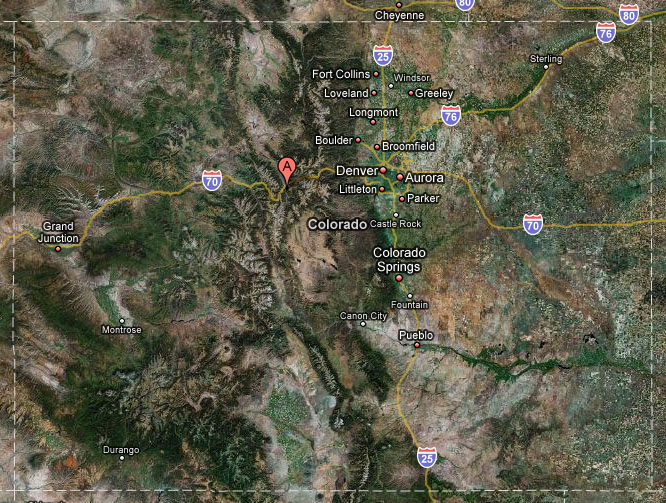
Approximate location within Colorado. Easy access via Interstate 70, which may
be blocked off at
Vail Pass (west) and the Eisenhower Tunnel (east). All other access points may
be denied and/or
monitored and controlled
Motor Vehicle Use Maps from
the U.S. Forest Service. Go to the
Travel Management & Off-Highway Vehicle Program Web site; click the link
under "Motor Vehicle Use Maps"; select a Colorado forest. The USFS advises that
new forest and district maps will be added by October 1, so check back!
The Criteria List - How the 2 Counties
Stack Up (follow links to detailed information)
Membership Goals:
Our target goals for voting age self-reliant survivalist members:
Grand County: 13,406 population x 15% = 2,011 members
Summit County: 28,296 population x 15% = 4,245 members
Total voting age members wanted: 6,256, although half that would make a BIG
difference to the counties.
If you already live in Summit or Grand Counties,
contact MEG to let us know!
Known Member Totals To-Date:
(does not include unidentified locals)
17
September 2008: 2
Please Read The Website Disclaimer!
Copyright 1986-2012, The Survival & Self-Reliance
Studies Institute (SSRsi), All Rights Reserved
Site conceptualized, designed, created & maintained by MEG Raven
Snail Mail: SSRsi, PO Box 2572 Dillon, CO. 80435-2572